Greenway
The Greenway is a natural route suitable for walking, cycling, and outdoor educational activities.
Hover over the image to enlarge it. Click to view it in full screen.
Vía Verde is a nature trail suitable for walking, cycling and outdoor educational activities.
Manacor – Artà Greenway
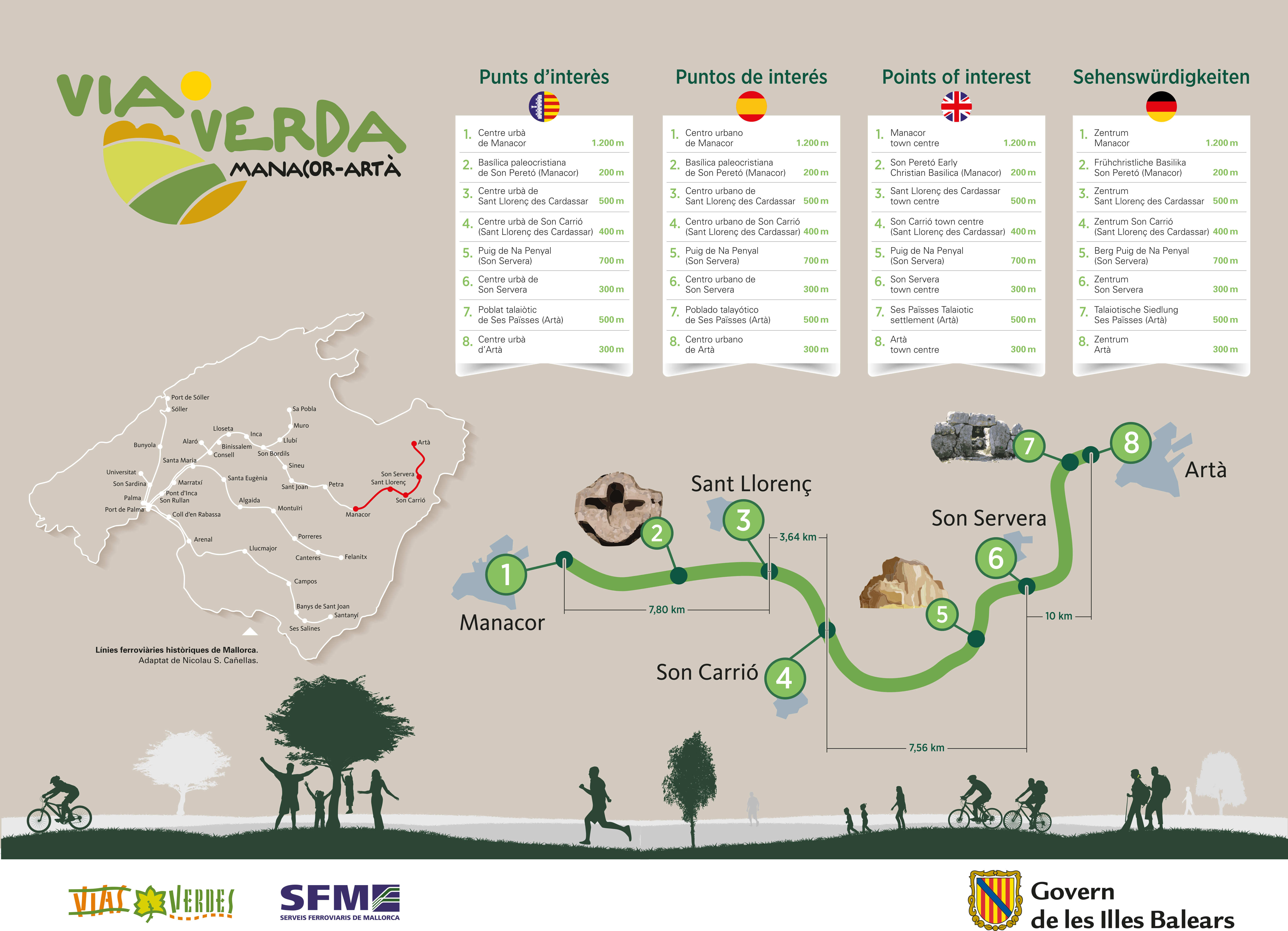
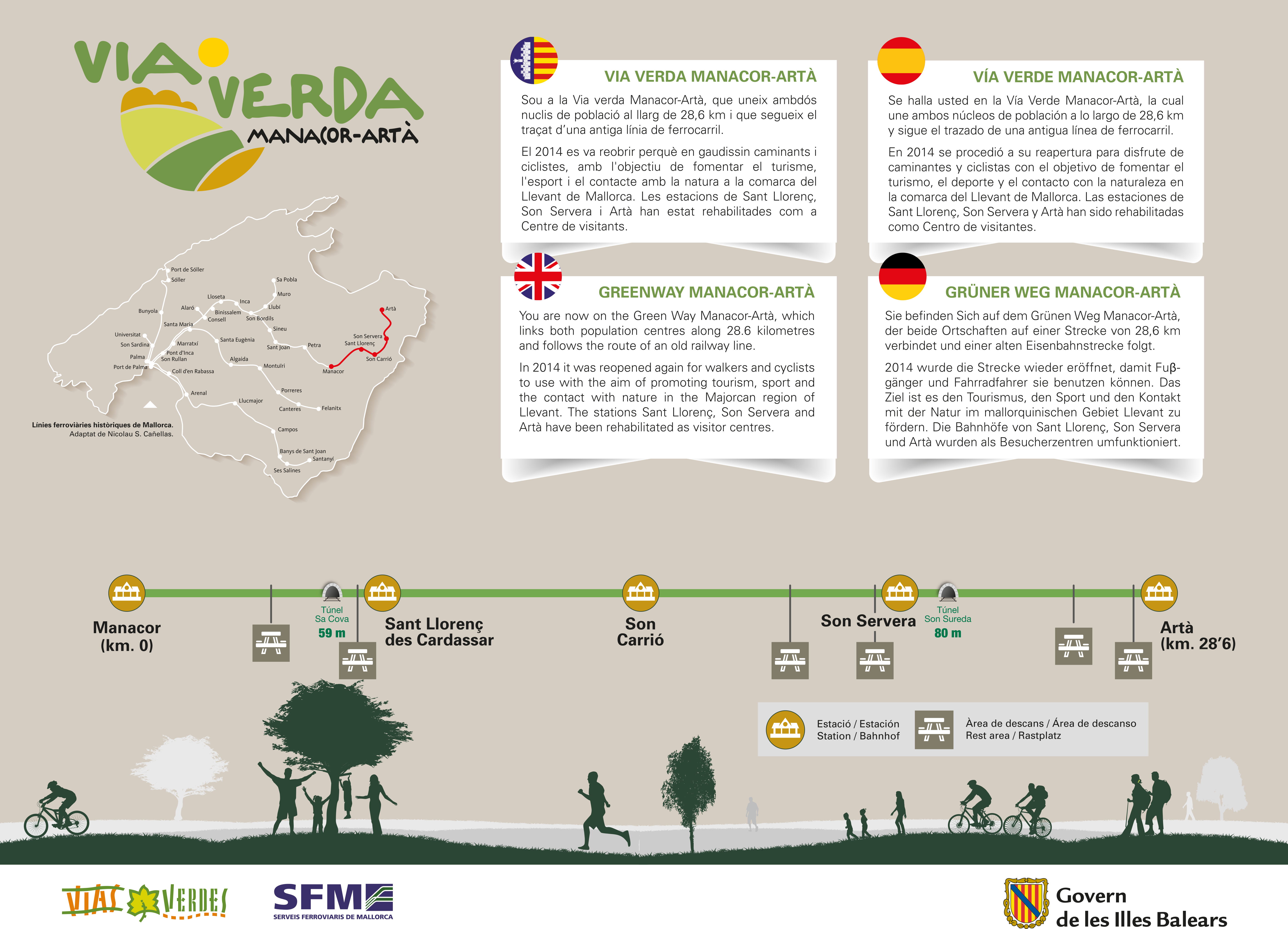
The Manacor-Artà Greenway follows the route of the old railway line that connected the eastern end of the Mediterranean island of Mallorca. The result is a new, easy and safe path that runs through the interior of the island, alternating between traditional agricultural fields and the Mediterranean forest of the hills that the train used to navigate in its search for the flattest route.
Between the towns of Manacor, the dynamic capital of the east, and Artà, bordered by the Llevant Peninsula Natural Park, lie the old stations of Sant Llorenç des Cardassar, Son Carrió and Son Servera, charming rural centres with rich gastronomy and an attractive cultural heritage.
The old railway line connected the villages and was not intended to go to the beach. However, in its middle section, it passes very close to the coast, offering magnificent sea views, and in Son Servera it connects with the cycle path that leads down to the fine sandy beaches of the east coast.
The greenway of the Mallorcan east coast is a unique space full of well-combined contrasts: the authenticity of the inland, highly attractive natural spaces and magnificent beaches with a wide range of tourist attractions.
Tachnical Specifications
- Fiited greenway: A route through the interior and along the coast of eastern Mallorca, following the old Manacor-Artà railway line.
- Localization: Between the towns of Manacor and Artà, located in the east of the island of Mallorca. Balearic Islands.
- Municipalities: Manacor, Sant Llorenç des Cardassar, Son Servera and Artà
- Length: 29 km.
- User profile: walkers, cyclists.
- Level of accessibility: Consult
- Type of surface: gravel and compacted earth.
- Natural environment:: The greenway is surrounded by alternating crops of cereals, vegetable gardens and plantations of carob, orange, olive, fig (carabassets) and almond trees, with Mediterranean forest of wild olive, Aleppo pine, mastic and rosemary; the characteristic landscape of the Serres de Llevant. Significant reforestation work has been carried out along the route. 4,800 trees (pines, holm oaks, wild olive trees, tamarinds, banana trees and mulberry trees) and 12,000 shrubs have been planted along its edges.
- The route passes very close to the beaches of Sant Llorenç des Cardassar (S'Illot, Sa Coma and Cala Millor) and Son Servera (Cala Millor, Cala Bona and Costa dels Pins), the Sa Punta de n'Amer Nature Reserve, the Serra de Sant Jordi mountain range and the Llevant Peninsula Natural Park.
- Other areas of natural interest:
- Manacor: beaches of S'Estany d'en Mas, Cala Anguila, Cala Mendia, Cales de Mallorca, s'Illot, Porto Cristo and Cala Murada.
- Artà: Cap de Ferrutx and Cap des Freu Nature Reserves and Llevant Marine Reserve.
- Cultural Heritage:
- Manacor: Historic quarter (known as Ses Dames), where the Mare de Déu dels Dolors church, the Torre del Palau tower, the Convent of Sant Vicenç Ferrer and the Torre de Ses Puntes tower stand out. In the surrounding area, you can see the Torre dels Enagistes (History Museum), the Talayotic settlement of s'Hospitalet Vell and the early Christian basilica of Son Peretó (200 m from the greenway). Caves of Drach and dels Hams (the hooks).
- Sant Llorenç des Cardassar: Rustic village, church of Sant Llorenç and Ses Sitges rural house. On the coast is the castle of Sa Punta n'Amer.
- Son Carrió: Museo del Ferrocarril de Mallorca, Iglesia de Sant Miquel Mallorca Railway Museum, Church of Sant Miquel.
- Son Servera: New Church, Talayotic remains of Puig, Pula and Ca s'Hereu, Church of Sant Joan Baptista, washing places, market, port of Cala Bona and coastal viewpoint of Des Pins.
- Artà: Talayotic remains of Ses Païses and Son Real, San Salvador fortress-sanctuary, Miquel Barceló documentation centre, Regional Museum, stately homes of Marqués, Cardaix and Sureda, Betlem chapel, fishing port and nurseries of Colònia de Sant Pere, Santa María de Bellpuig monastery and Aina Mª Lliteras de Can Cardaix foundation.
- Infraestructura:Greenway. 3 tunnels and 4 stations.
- Infrastructure facilities:
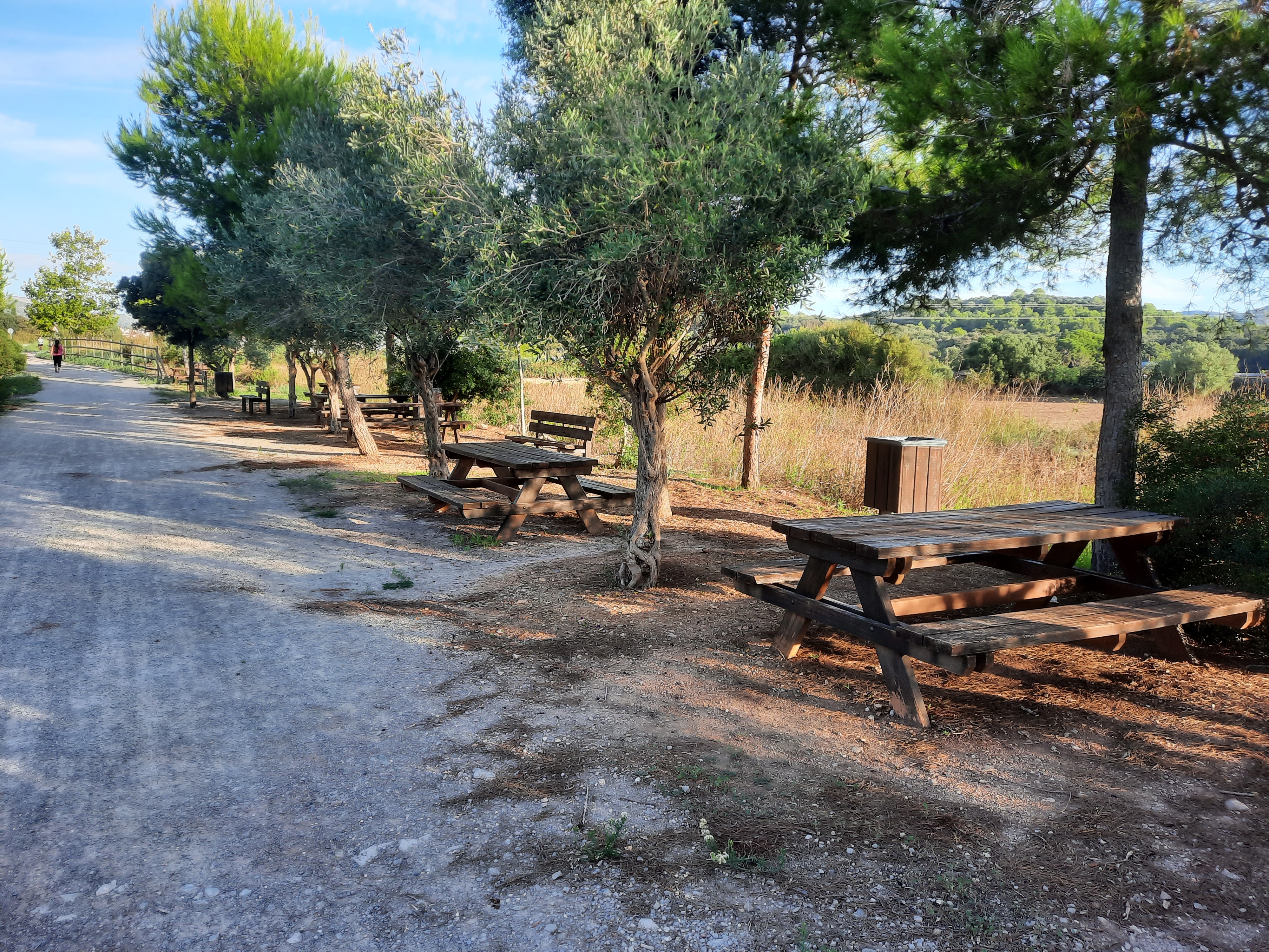
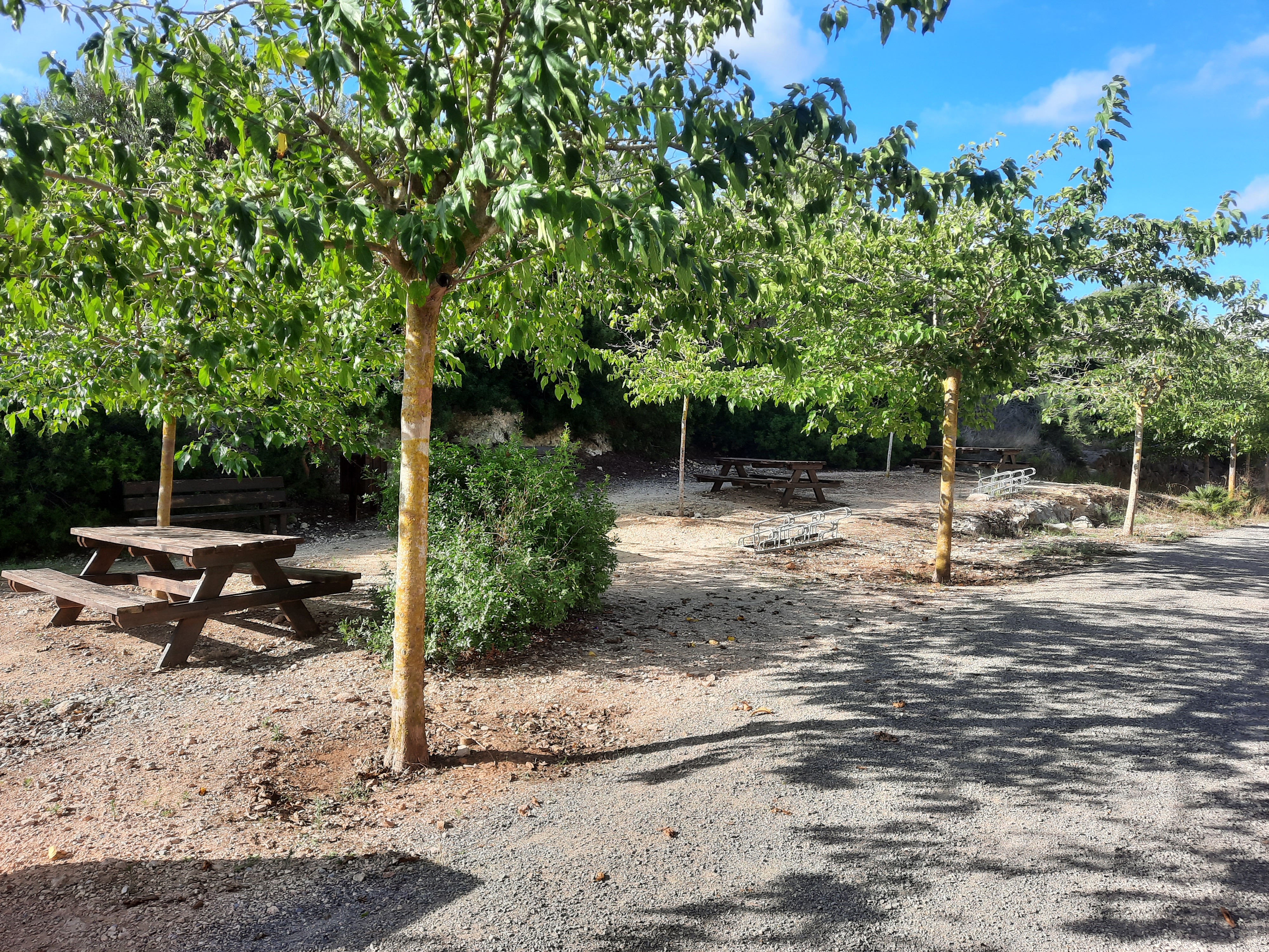
- 8 rest areas with benches, tables, bicycle racks and litter bins.
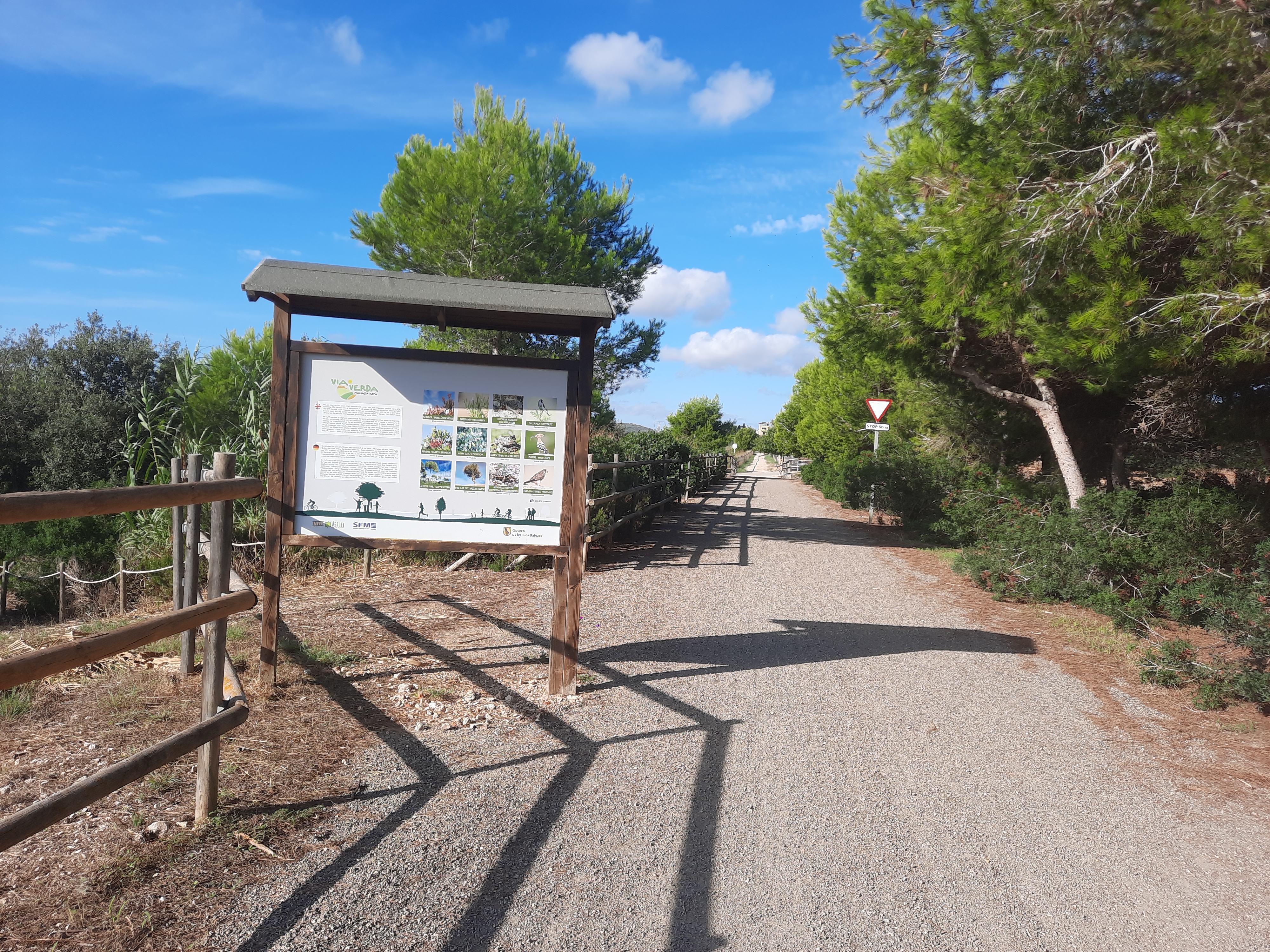
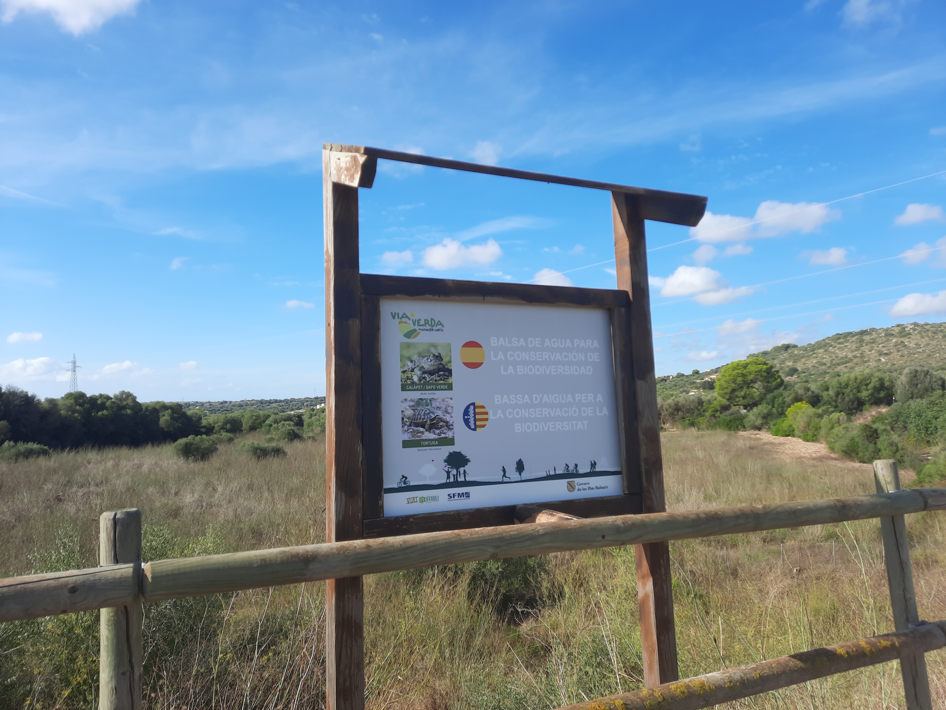
- Information panels with points of interest and information on vegetation and fauna.
- 15 CCTV cameras.
- Facilities at stations:
- Sant Llorenç Station: parking area, restaurant area and children's play area.
- Sant Miquel (Son Carrió) Station:Railway Museum, parking area and urban park.
Artà Station: Passenger building used as a craft centre and tourist information point, and another building used as a bar-pub.
- How to get there:
- By car:
If you are coming by car, these are the main access points:
- Access nº1. Manacor. Start of the Greenway: On the bend of Passeig de Ferrocarril, east of the city (next to a hypermarket car park).
- Access nº2. Old train station: Direct access from the PMV-4022, entrance road to Sant Llorenç from the Ma-15 roundabout.
- Access nº3. Son Carrió. Old train station: On the way to the cemetery (Carrer de l'Estació).
- Access nº4. Son Servera: The greenway crosses with the carrer de Formentera. The reference will be the bike path that goes down from Son Servera towards the beach area and with which the greenway coincides for a few metres. A small park and the bio-healthy circuit will give you the clue
- Access nº5. Artà. Old train station (end of Vía Verde): parallel to the Ma-15 (Avinguda de Costa i Llobera), south of the town.
- By train: Serveis Ferroviaris de Mallorca. Manacor Station. Line T3: Palma de Mallorca--Manacor.
Telephone:
871 93 00 00 - By bus: Transportes de las Illes Balears (TIB). Mallorca Transport Consortium. Customer service office (Palma Intermodal Station).
Telephone:
971 177 777- Bus Line 411:Manacor-Cala Rajada
- Bus Line 412:Manacor-Costa dels Pins
- Bus Line 416:Manacor-Cales de Mallorca
- Bus Line 417:Manacor-Son Carrió
- Connections: Palma: 53 km to Manacor y 75 km to Artà.
- By car:
If you are coming by car, these are the main access points:
Key kilometres: Km. 0 / Km. 7,8 / Km. 11,4 / Km. 18 / Km. 29
Km 0
The Manacor-Artà greenway begins at the eastern limit of Manacor. The exact place is on the bend of the Passeig del Ferrocarril before it flows into the Plaça de Madrid, a roundabout where the street (signposted to Palma), the Passeig de Antoni Maura (signposted to the town centre), the Avinguda del Parc (signposted to Porto Cristo) and the MA-4100 road (signposted to Cala Rajada) converge.
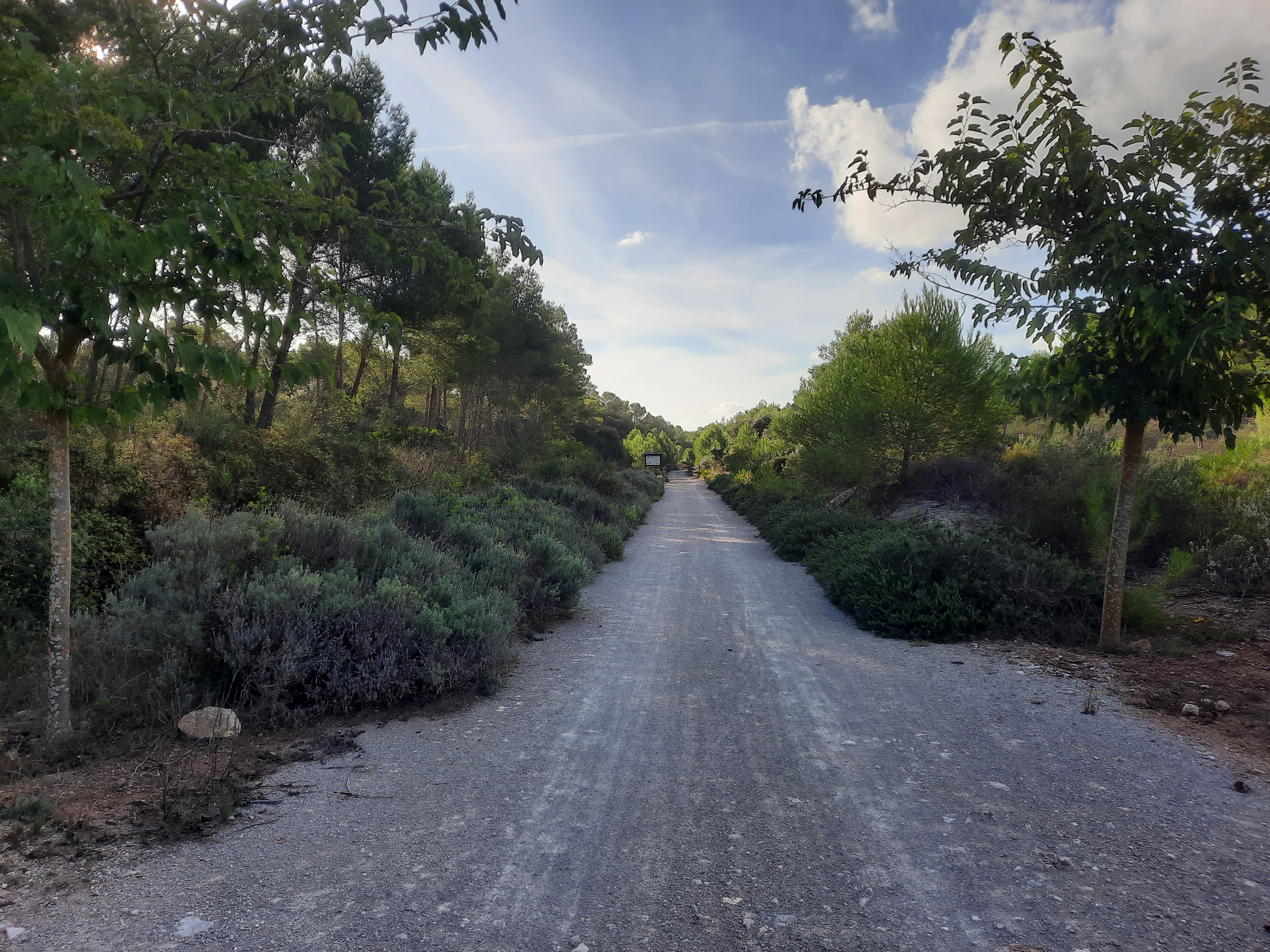
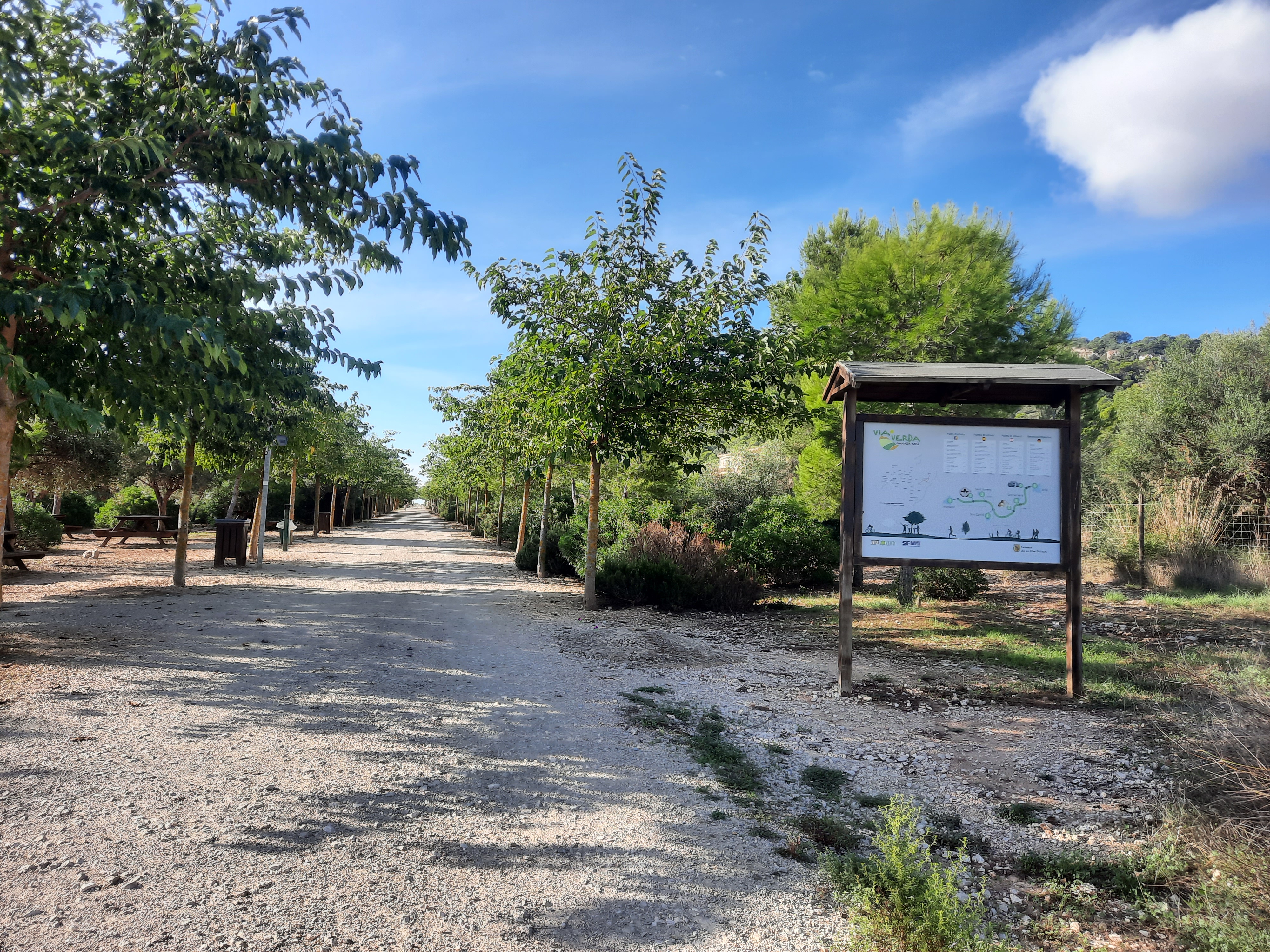
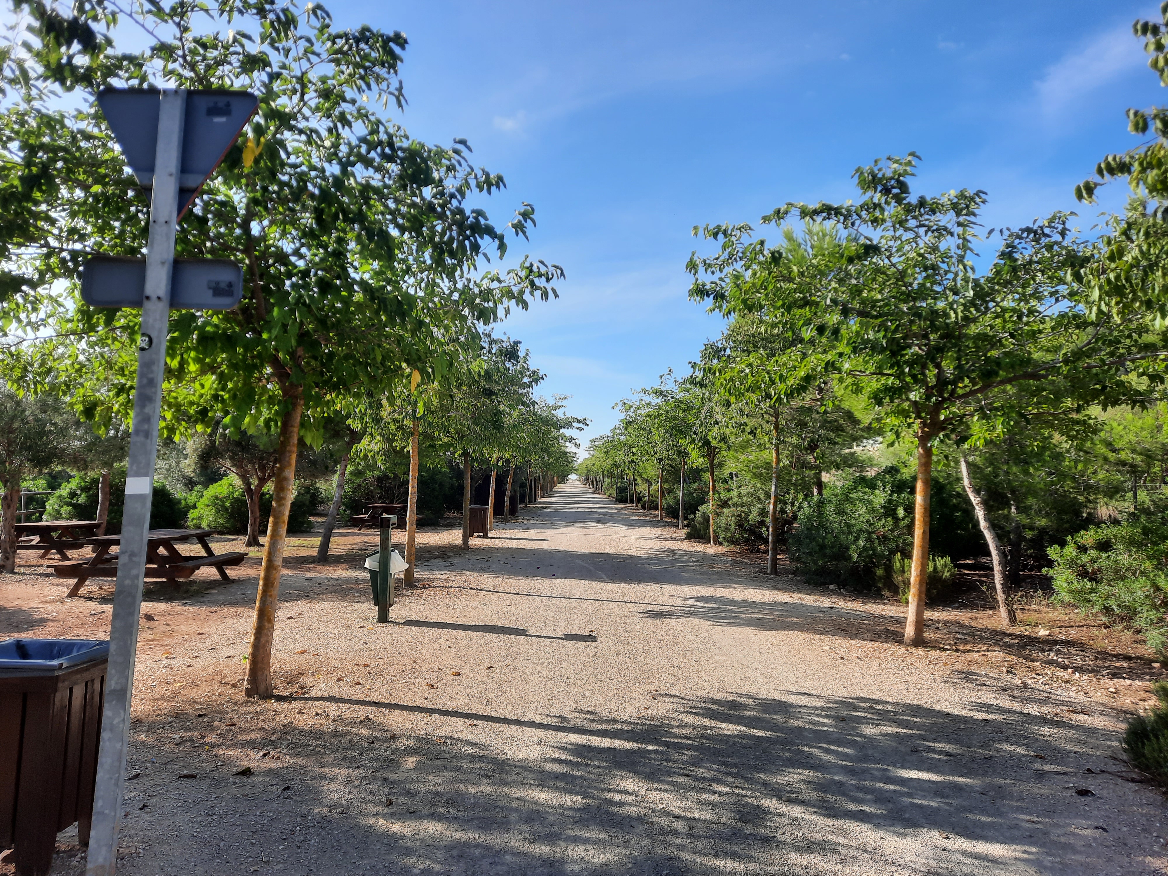
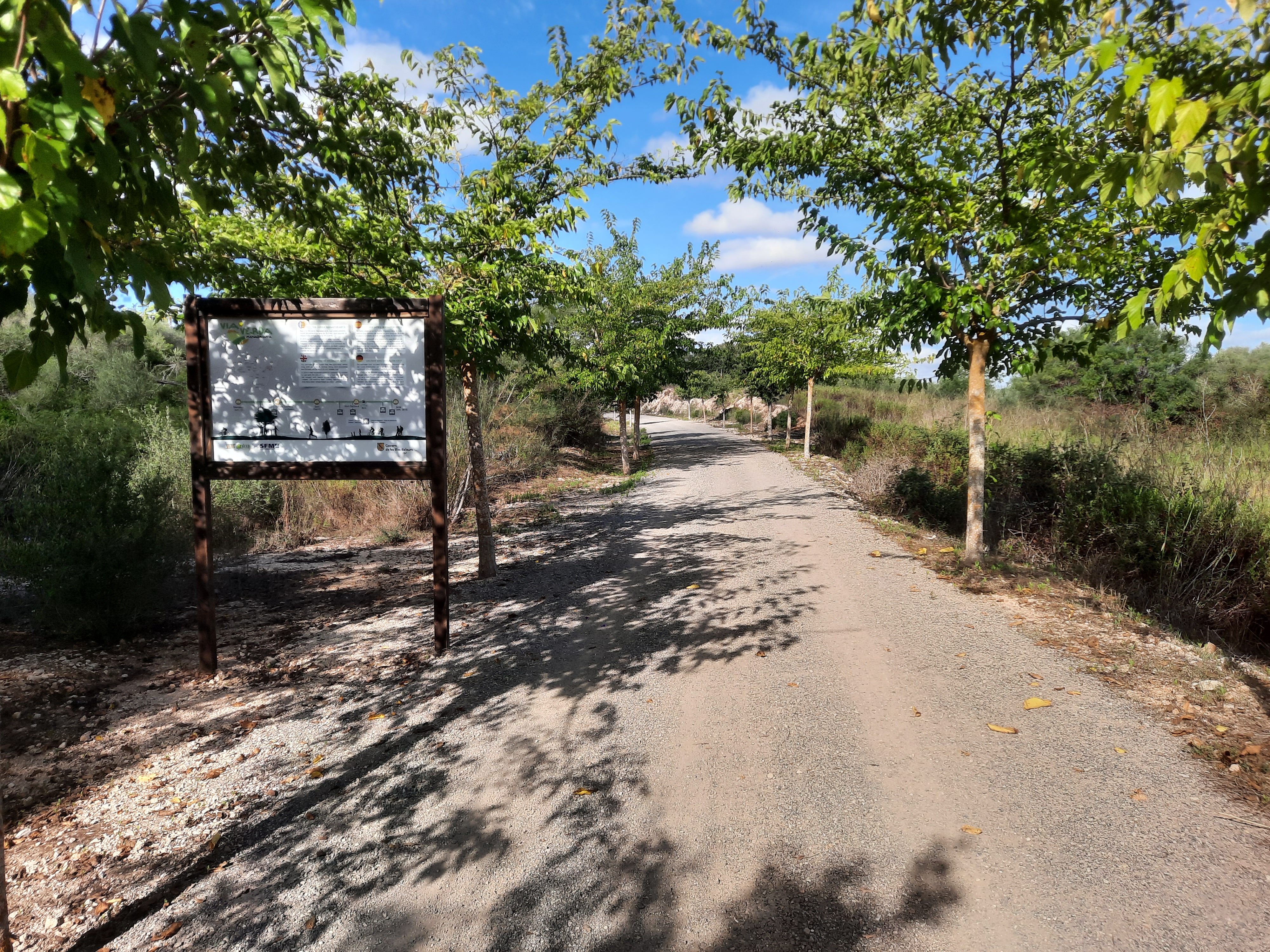
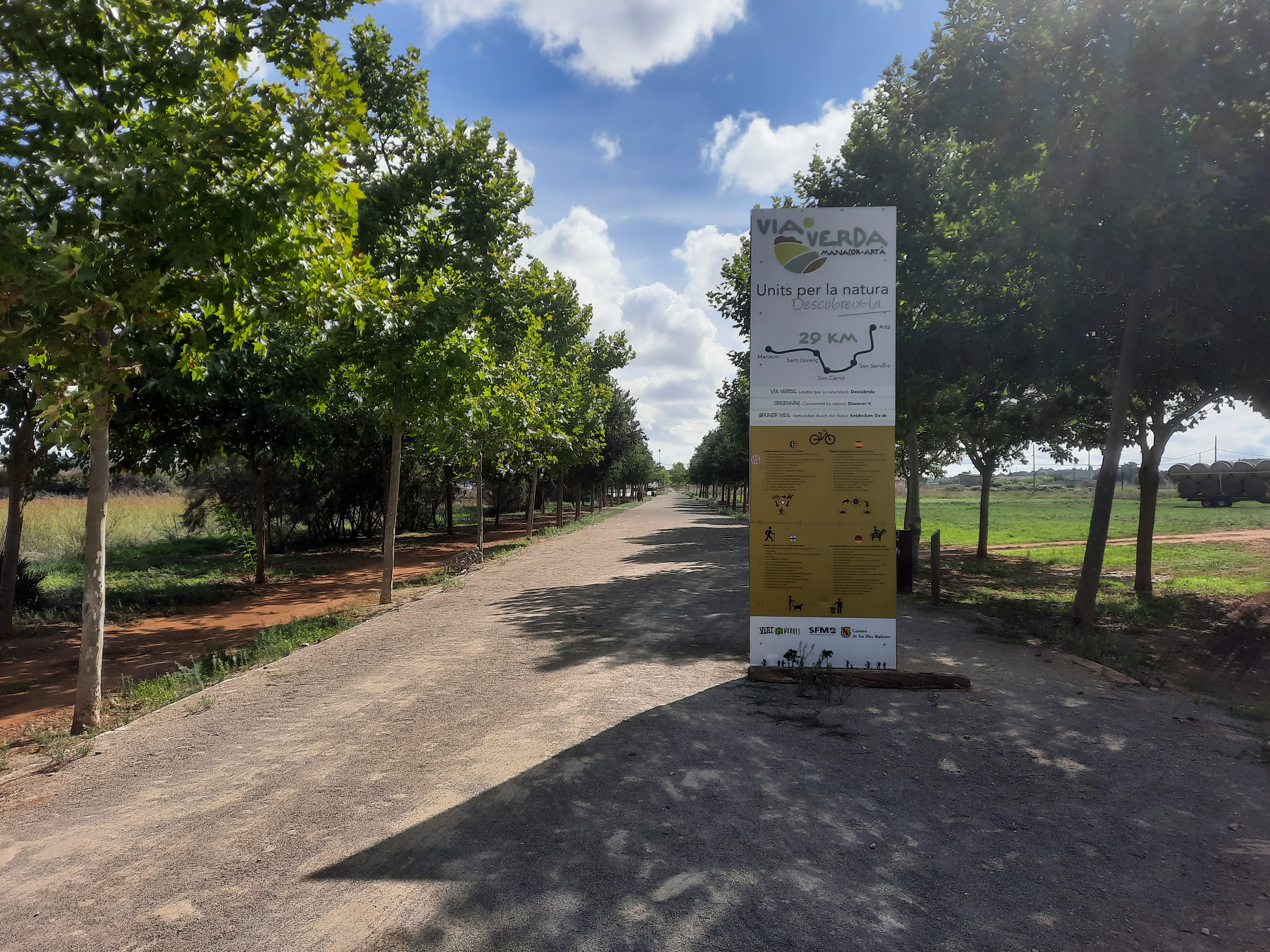
The old road now appears as a simple gravel road, surrounded by a wide open space of agricultural fields. It's identified by two information panels: one with the rules of the greenways and another where our location with respect to the points of interest of the route is reflected. Wooden railings are also characteristic. These elements of Security personnel close off access to motor vehicles at each crossing and, in sections, cordon it off on both sides to prevent falls.
However, we won’t find a dedicated parking area. Parking is provided along the busy two-way Passeig del Ferrocarril. That’s why it’s common to use the parking lot of as nearby hypermarket, which is accessed via the Cala Rajada road (MA-4100) and offers the opportunity to stock up for the trip.
There is no transition. The greenway winds through farmland dotted with scattered stone farmhouses, leaving behind the urban centre of the capital of eastern Mallorca beneath the tall, slender Torre Rubí of the Mare de Déu dels Dolours.
To the east, the old railway bed winds through a gently undulating landscape; easy terrain where it traces long straight stretches interrupted by wide, entrenched curves, transformed into a roller coaster of gentle ascents and descents.
In its early stages, it passes through a landscape of green or golden cereal carpets, rows of carob and almond trees, orchards of various crops, corrals, and sheep grazing freely. It is the traditional Mallorcan countryside, the sustenance before the manna of tourism.
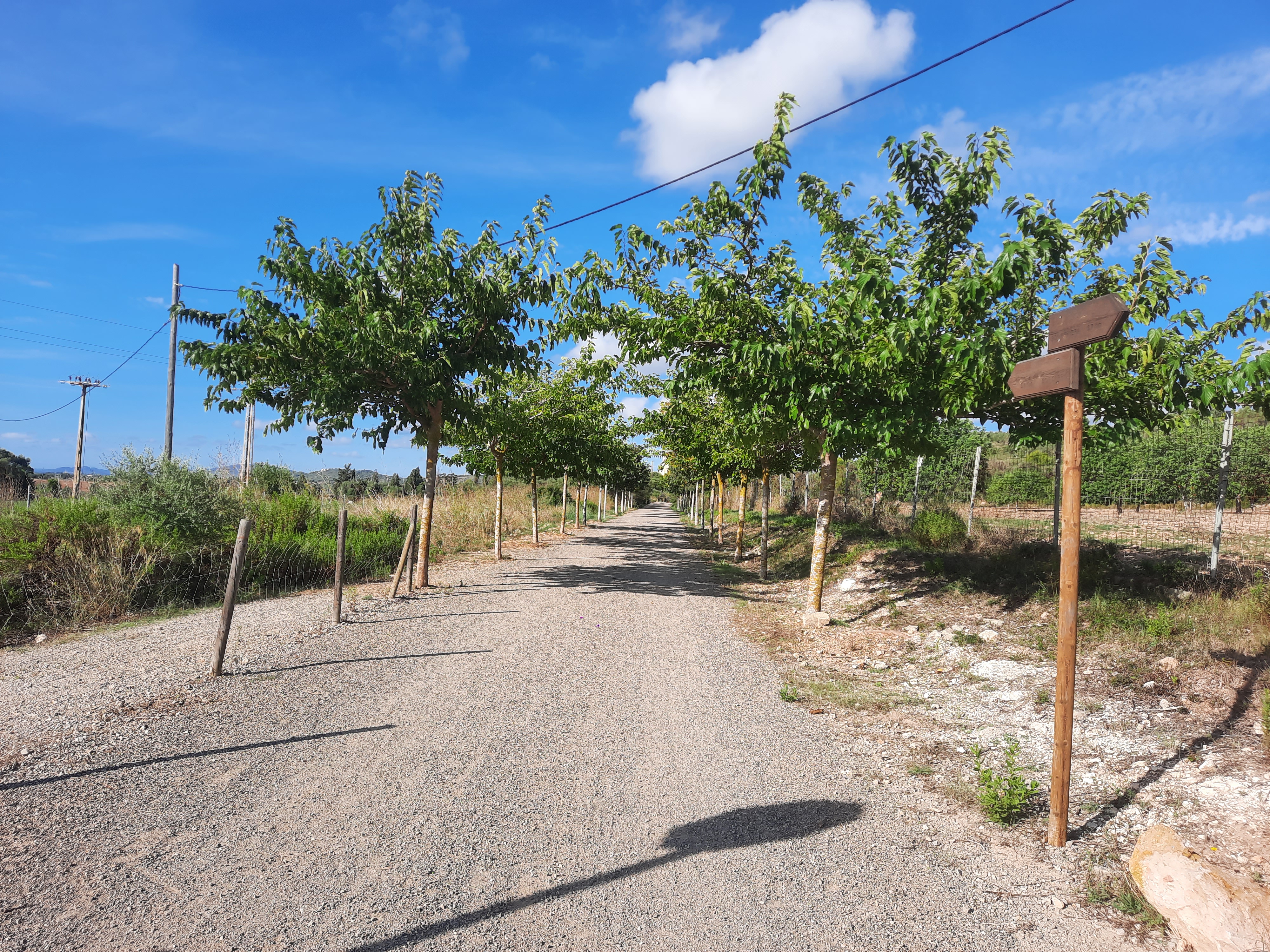
This treeless stretch, truly striking in spring, isn’t always appreciated, especially in summer. For this reason, the platform has undergone extensive reforestation. Two rows of pines, holm oaks, wild olive trees, tamarinds, banana trees, and mulberry trees line it almost from start to finish. Over time, the trees form an inviting green, shaded corridor. The old railway line is now an escape route from the large city of Manacor and has become a popular walking area.
On this stretch we’ll also find a point of interest: the early Christian basilica of Peretó. A left turn leads to the parallel MA-15. The remains of its foundations are just across the asphalt, very close by. Be very careful when crossing the busy road!
A magnificent viewpoint overlooking Sant Llorenç des Cardassar marks the end of this stretch of long straightaways. It is a high embankment towering above the uniformly earth-toned village.
The viewpoint is followed by the short, straight Sa Cova tunnel (59 m), features that allow full visibility inside its rock-hewn gallery.
Km 7,8
After the tunnel is the Sant Llorenç station (km 7.8), although the station nameplate reads “San Lorenzo.” This is the first in a collection of stations built to the same stylistic pattern. Rectangular masonry buildings with gabled ceramic tile roofs and a lovely modernist feel thanks to the stone details that crown the roofs and facades.
All the stations along the Greenway have been restored and will be converted into public venues, potentially housing anything from a restaurant to sociocultural or sports activities.
The Sant Llorenç complex consists of the passenger building, the freight warehouse, and the restrooms, and the platforms have been transformed into an exceptional viewpoint: at your feet lies the Ses Planes Torrent, then the village beneath the silhouette of the church, and in the background the distant pine-covered mountains.
Next to the station there is a children’s play area and a large parking lot reached by an asphalt path that connects the station to the town. This access is the most recommended for bicycles and people with reduced mobility. Pedestrians have the option of using a more direct, stepped access.
We left Sant Llorenç behind, passing through fields of carob, orange, and almond trees, to embark on a particularly scenic stretch. Halfway to Son Carrió, the terrain becomes rugged due to small hills covered with remnants of Mediterranean forest. The route curves, and the verges turn green with mastic trees, wild olive trees, tall Aleppo pines, holm oaks, and carob trees.
Having regained its straight course, the old track crosses the Ses Planes Torrent. The bridge is unique: it features magnificent “balconies” (which served as safety refuges when the train passed) topped with eye-catching machicolations.Further on, there is a large, modern-looking ship, in front of which a wide esplanade stretches out.
Km 11,4
Son Carrió is a small village with plenty of rural charm and boasts bakeries where you can buy its renowned apricot cocas. The town centre is just a short walk away: simply retrace your steps from the cemetery along the paved S’Estació street (you’ll see the sign). The street descends to the bridge over the stream and ends at the Sant Llorenç–Cala Millor road (the main street), in front of the beautiful Neo-Romanesque facade of the Church of San Miguel, whose windows are closed with colourful stained glass.
At the Son Carrió station, we currently find the Mallorca Railway Museum, a museum that invites you on a journey through time via an audiovisual experience in which history and technology come together to move us with immersive music, digital mappings, and even the locomotive’s smoke—a truly unique presentation. We can board a restored historic carriage to embark on a journey into the past. To conclude the visit, the museum features an interactive area with games, digital resources, and a driving simulator.
The section between Son Carrió and Son Servera is the flattest and most coastal part of the route. It doesn’t reach the beach itself, but it runs very close to the sea. The old route runs inland parallel to the coastline, offering from its privileged vantage point sweeping sea views that stretch from the beaches of s’Illot to the Costa dels Pins.
The greenway leaves Son Carrió behind along a straight embankment that, elevated above fields of orange and almond trees, offers a magnificent panoramic view of the town and the church.
Shortly, the track will make a wide railway curve to bypass the elevations whose slopes gently descend towards the coast, covered in trees and scrub. In that natural setting, there are charming, traditional-style single-family homes.
The turn culminates with the entry into the Sa Punta tunnel, flanked on both sides by two rural farmhouses (Sa Punta and Torre Nova). The stone-lined gallery is short, straight, and offers full visibility inside. After the tunnel, a new straight stretch unfolds between rows of fruit trees, where for the first time you get broad, clear views of the sea. From right to left, you can see Sa Coma beach, Punta de n’Amer, and Cala Millor. Even from here, it’s quite a spectacle to watch the waves break against the cliffs of the Punta de n’Amer Natural Reserve on stormy days.
The Vía Verde once again makes a wide railway curve to bypass Na Penyal, a mountain of great interest rising above the sea, with striking limestone cliffs emerging from dense, green woodland. As a curiosity, it’s worth noting that during the last Spanish Civil War, a halt was built nearby to serve a coastal battery of four cannons located at Na Penyal.
The turn at Na Penyal offers magnificent views of Cala Millor, making it the point on the route closest to the beach. The old railway line, now surrounded by housing developments, crosses several paved access roads that slope down to the Porto Cristo road and the coast—a real temptation to abandon the greenway in favour of the beach. It may be difficult to resist such a rapid descent, but the best course of action is to use the bike lane that will appear further ahead in Son Servera.
On the final stretch into Son Servera, after passing through a long trench, the panoramic views are once again magnificent. Now you can see Cala Bona and the Costa dels Pins in detail, the maritime end of the Sierra de Sant Jordi.
Km 18
At the entrance to Son Servera, the path merges into the red-surfaced bike lane that runs from the town to Cala Millor beach. The greenway continues to the left. To the right, the bike lane runs alongside the MA-4026 road until it reaches Cala Millor (2.5 km), where it connects with another bike lane that runs the entire length of the Son Servera Bay promenade (from Punta de n’Amer to Costa dels Pins). If you intend to head to the beach, this is the most convenient and safest way to reach the sea. Logical warning: returning to the road will require the effort of climbing back up to it.
Continuing along the bike lane and the Vía Verde to the left, you’ll reach a park with picnic tables, an outdoor fitness circuit, a playground, and a working fountain, located at the entrance to the town centre of Son Servera. A few meters further up there is a roundabout where two options arise again: continue the bike lane or leave it to follow the greenway. The bike lane continues to the town centre of Son Servera, where you can enjoy its cuisine or visit the open-air Iglesia Nueva, which is highly recommended.
The Vía Verde, on the other hand, crosses the road to the right via a bike crossing over the roundabout. After crossing this road, the Vía Verde begins a long straight stretch that runs along the entire eastern edge of the town, reaching the Son Servera station (km 19). The complex, cut from the same aesthetic cloth as the rest, comprises the passenger building, the warehouse, and the restrooms.
Behind us lies the scene formed by the church’s silhouette and the mountainous outline of Puig de Sa Font above the town centre of Son Servera. After a long stretch on level ground, the Vía Verde descends on an embankment over agricultural fields and the outskirts of the town of Son Servera. This peri-urban section ends as it passes through the Son Sureda tunnel at Puig de Son Sard, a hill that turns yellow with scrub in spring. The gallery carved into the living rock, partly lined with stone, is the longest on the route (80 m) and curves to the left, but inside there is full visibility.
Once past the tunnel, a long uphill stretch of great scenic beauty begins. The greenway passes through an area of fruit orchards (orange, carob, and almond trees) and golf courses, dotted with hills covered in remnants of Mediterranean forest and scrub, where a series of different and magnificent panoramic views of the Sierra de Sant Jordi pine forest unfold.
Shortly after crossing the MA-4041 road at grade (km 24.6), the road makes a wide left turn to bypass Son Catiu, a hill covered in dense woodland, at the foot of which is a rest area (km 25.2).
The greenway approaches Artà through a wide, flat open space dominated by cereal fields, fruit orchards, livestock pastures, vegetable gardens, and scattered rural stone houses. The final stretch of the Vía Verde runs along easy terrain where the railway bed continues to climb slightly, heading towards a horizon where the Sant Salvador sanctuary and the parish church stand out above the rooftops of Artà.
Km 29
Upon entering Artà you cross the track leading to the Talayotic settlement of Ses Païsses, and a street where the level-crossing barrier is still preserved next to the former train depot, now occupied by a pub-café. Finally, you reach the Artà station (km 29), located beneath the maze of narrow, labyrinthine streets that make up the town centre. The station complex is the most important of those seen so far. It features a large, two-story passenger building, restored and converted into a crafts and information centre, a freight warehouse, restrooms, a coal shed, and a water tower, among other railway elements.
The history of the railway in Mallorca began in 1875 with the inauguration of the line between the capital, Palma, and the main town in the island’s centre, Inca. That first line was later extended to Manacor. In 1876, the feasibility study was published, and three years later, in 1879, the train reached the capital of Mallorca’s eastern region. The extension to Artà, passing through the municipalities of Sant Llorenç des Cardassar and Son Servera, is then considered. In 1913, Rafel Blanes, a lawyer from Artà, promoted the works, which lasted five years. The first steam train arrives in Artà in 1921.
Mallorca’s rail network reached its peak in the 1930s, with 10 lines, 40 stations, and 250 km of track (proportionally twice as much as on the entire Spanish mainland). However, from that moment on, road transport gained the upper hand. The train begins its decline, and in 1964 the first line (Mallorca–Santanyí) is closed.
After years of degradation of the Majorcan rail network, a renewal plan is launched. But the Inca–Artà line is not very profitable, so it is excluded from the renewal process. In 1977, an accident precipitated the closure of the Enllaç (Bordils)–Manacor section: a Ferrostal train collided with a car at a level crossing. Ferrocarriles de Mallorca lacked the capital to carry out the necessary modifications, and the government decided to close the line.
With the closure of the Empalme–Manacor section, the extension to Artà is also closed after 56 years of operation.
It wouldn’t be until 1999 that the Government of the Balearic Islands would launch a plan to restore the island’s railway. In 2003, the Inca–Manacor line was reopened.
The infrastructure is then reoriented to take advantage of at least the work already done, and the former railway line begins to be restored as a greenway under the direction of Serveis Ferroviaris de Mallorca, which will also be responsible for its subsequent maintenance and management. In 2015, the Manacor–Artà Greenway was inaugurated along the route of the former steam railway, making it the first Greenway in the Balearic Islands.
Popular festivals
- Manacor:
- Sant Antoni. January 17
- Spring fair and festivities. June 1
- Mare de Déu del Carme. July 16
- Sant Llorenç des Cardassar:
- Sant Llorenç Patron Saint Festivities. August 10
- Festivities of the Mare de Déu Trobada. September 8.
- Son Servera:
- Sant Joan Patron Saint Festivities. June 24.
- Festivities of the Mare de Déu del Carme in Cala Bona. Mid-June.
- Festivities of the Mare de Déu dels Àngels in Cala Millor. Late July.
- Artà:
- Sant Antoni. January 16 and 17.
City councils
-
Manacor:
Tel: 871 93 00 00
Website: manacor.org -
Sant Llorenç des Cardassar:
Tel: 971 834 393
Website: santllorenc.es -
Son Servera:
Tel: 971 567 002
Website: sonservera.es -
Artà:
Tel: 971 829 595
Website: arta.cat
Emergencies
Emergencies: Phone. 112
Ferrocarril
Serveis Ferroviaris de Mallorca: Line T3 Intermodal Station–Manacor
Tel: 971 177 777
Website: www.trensfm.com
Buses
Balearic Islands Transport (TIB) :Mallorca Transport Consortium
Tel: 971 177 777
Website: www.tib.org
Airport
Mallorca (Palma) Son Sant Joan Airport:11 km. Southeast of Palma de Mallorca
Airport code: PMI
Tel: 913 211 000Website: www.aena.es
www.caib.es
Government of the Balearic Islands website
www.illesbalears.es
Official tourism portal of the Balearic Islands
www.manacor.org
Municipal information for Manacor
www.visitmanacor.com
Manacor Tourist Website
www.santllorenc.es
Municipal website of Sant Llorenç des Cardassar.
www.visitsantllorenc.com
Tourist website of Sant Llorenç. It contains information about the towns of Sant Llorenç, Son Carrió, Cala Millor, Sa Coma, and S’Illot.
www.sonservera.es
Information about the municipality of Son Servera. It has its own tourism website.
www.arta.es
Artà Municipal Website
www.artamallorca.travel/es
Web de turismo de Artà
www.visitcalamillor.com
Information about Cala Millor
www.masmallorca.es
Mallorca’s environment, leisure, and culture magazine.
You can view the entire route directly from here:
Explore images of the Greenway route and its surroundings.